Skip to Main Content
_
Sensor Network
Maps & Radar
Severe Weather
News & Blogs
Mobile Apps
More
Search
close
gps_fixed
gps_fixed
Find Nearest Station
Manage Favorite Cities
Log In
Go Ad Free
account_box
Log in
Go Ad Free
settings
Settings
Sensor Network
Maps & Radar
Severe Weather
News & Blogs
Mobile Apps
Historical Weather
star
Current Weather for
Popular
Cities
San Francisco, CA
65
°
F
Partly Cloudy
Manhattan, NY
warning
65
°
F
Cloudy
Schiller Park, IL (60176)
warning
73
°
F
Heavy Rain
Boston, MA
58
°
F
Light Rain
Houston, TX
warning
82
°
F
Cloudy
St James's, England, United Kingdom
60
°
F
Cloudy
Search
close
gps_fixed
gps_fixed
Find Nearest Station
Manage Favorite Cities
settings
--
Feels like
--
--
--
/
--
--
--
--
--
--
--
--
--
--
12AM
6AM
NOON
6PM
12AM
May 16
+0000
May 17
Full Forecast
Excessive Rainfall, Severe Storms To Spread Across States In The South
Scattered severe storms and flooding rain will affect the South to end this week. Here's what to know.
Excessive Rainfall, Severe Storms To Spread Across States In The South
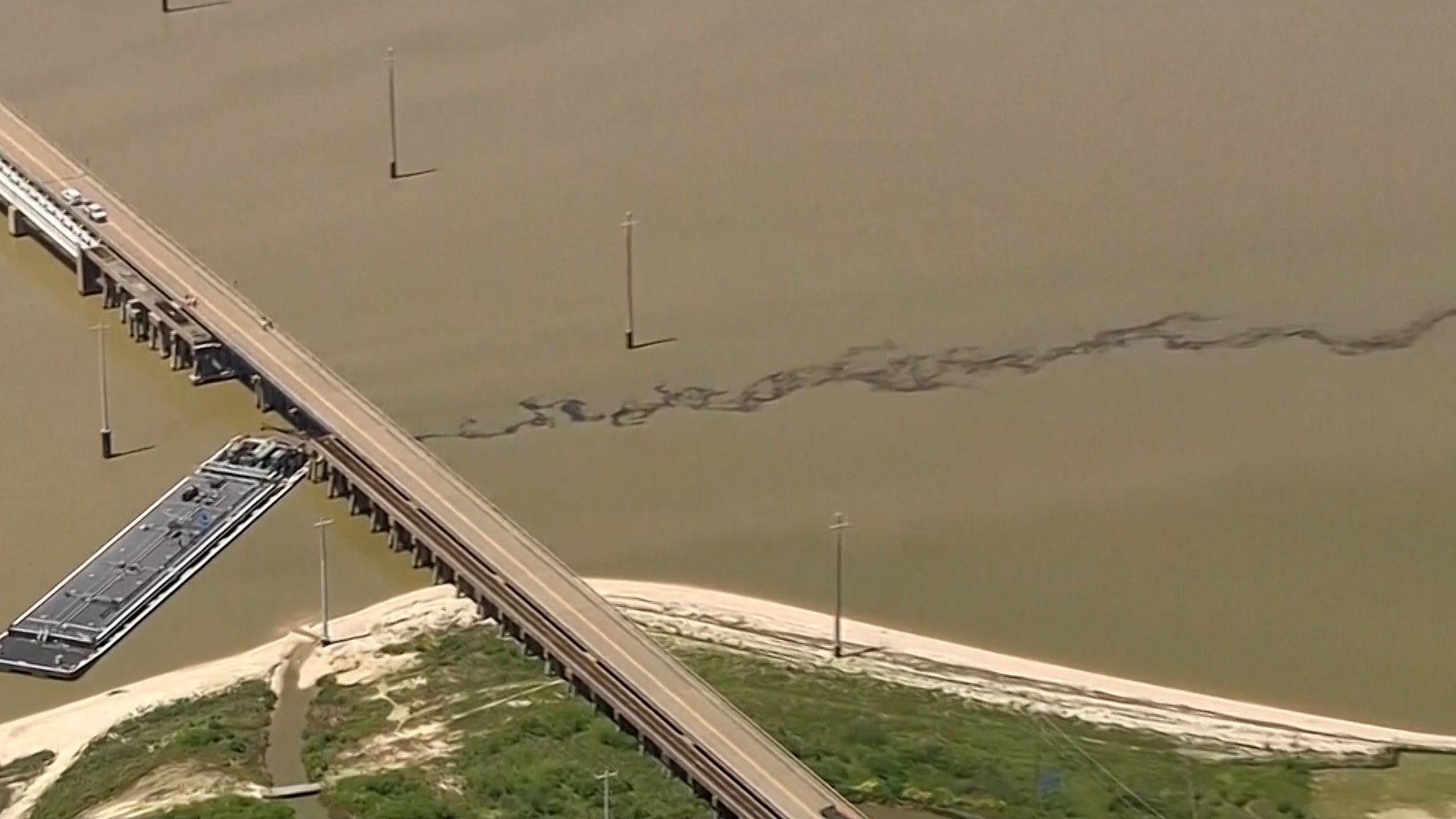
Barge Crash Shuts Down Bridge, Oil Pours Into Bay
Here's what we know so far.
Barge Crash Shuts Down Bridge, Oil Pours Into Bay
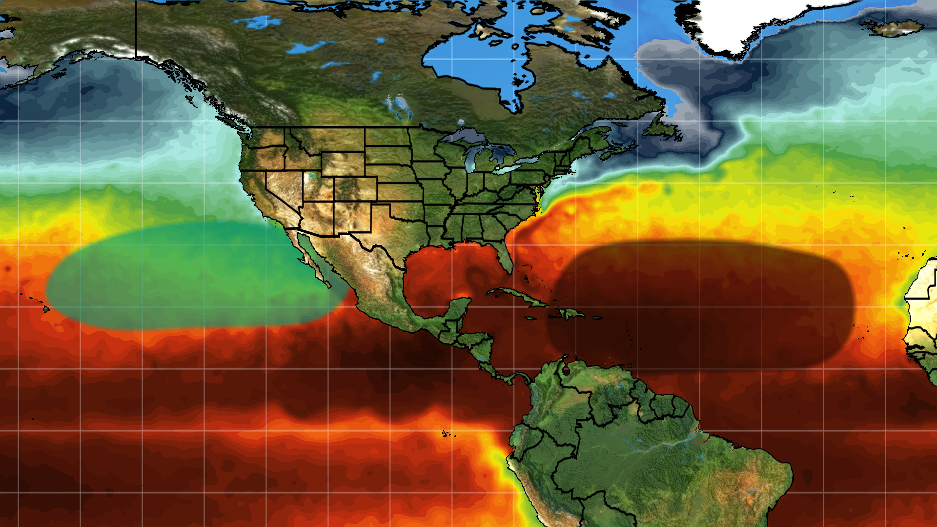
New Atlantic Hurricane Season Outlook: What You Can Expect
We’re now less than two weeks before hurricane season officially kicks off and the number of hurricanes expected this year continues to increase. Here are our latest expectations.
New Atlantic Hurricane Season Outlook: What You Can Expect
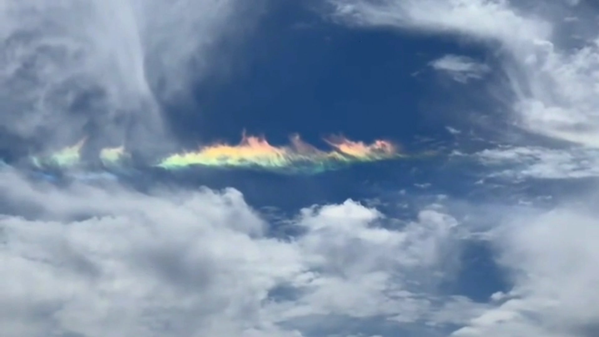
Rare Look At A 'Fire Rainbow'
So when is a rainbow not a rainbow? When it's a fire rainbow. Watch this video to see the beautiful and rare phenomenon and learn how it happens.
Rare Look At A 'Fire Rainbow'
How 'High Risk' Flood Forecasts Could Be Life-Threatening
This is another forecast that should grab your attention.
How 'High Risk' Flood Forecasts Could Be Life-Threatening
Please enable JavaScript to continue using this application.