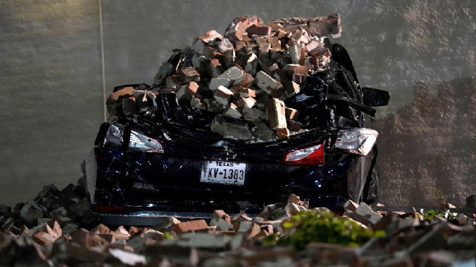
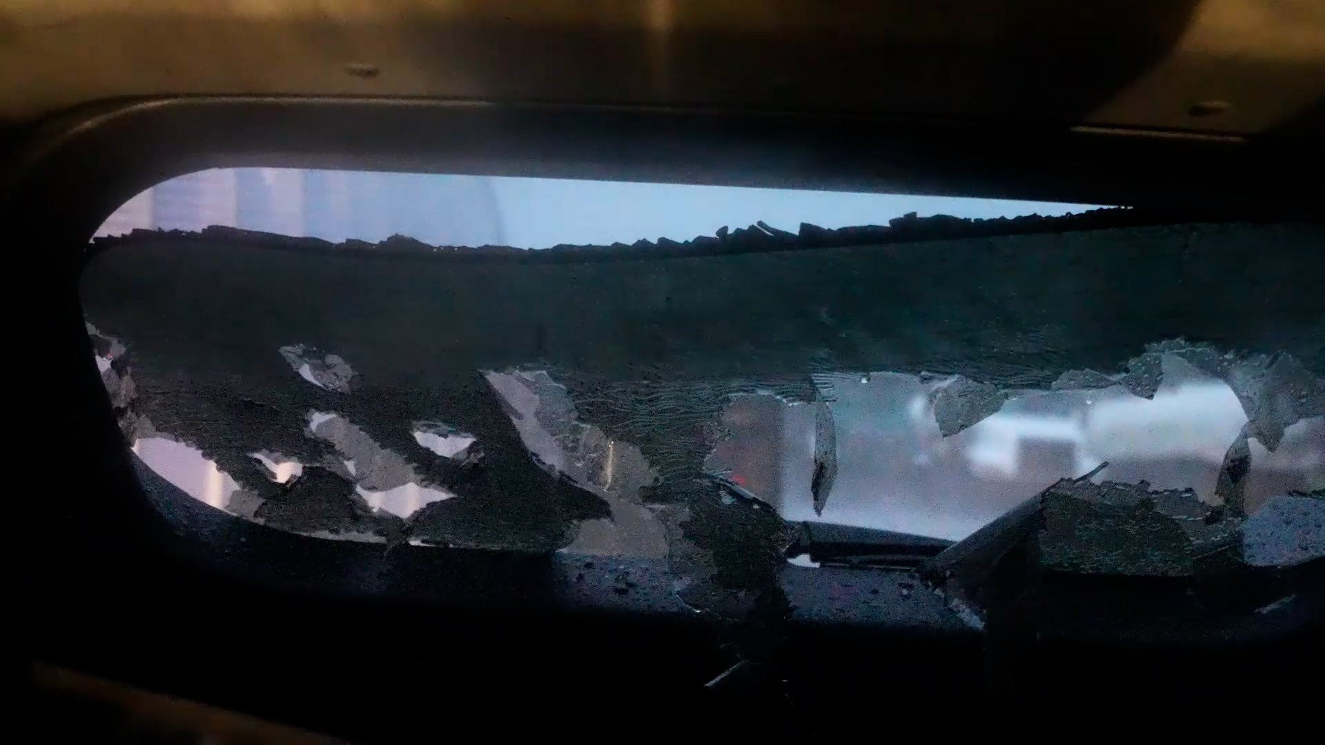
Severe storms hit northern and central Oklahoma with large hail that just destroyed cars. This video takes you inside one car as the hail shatters its windshield.
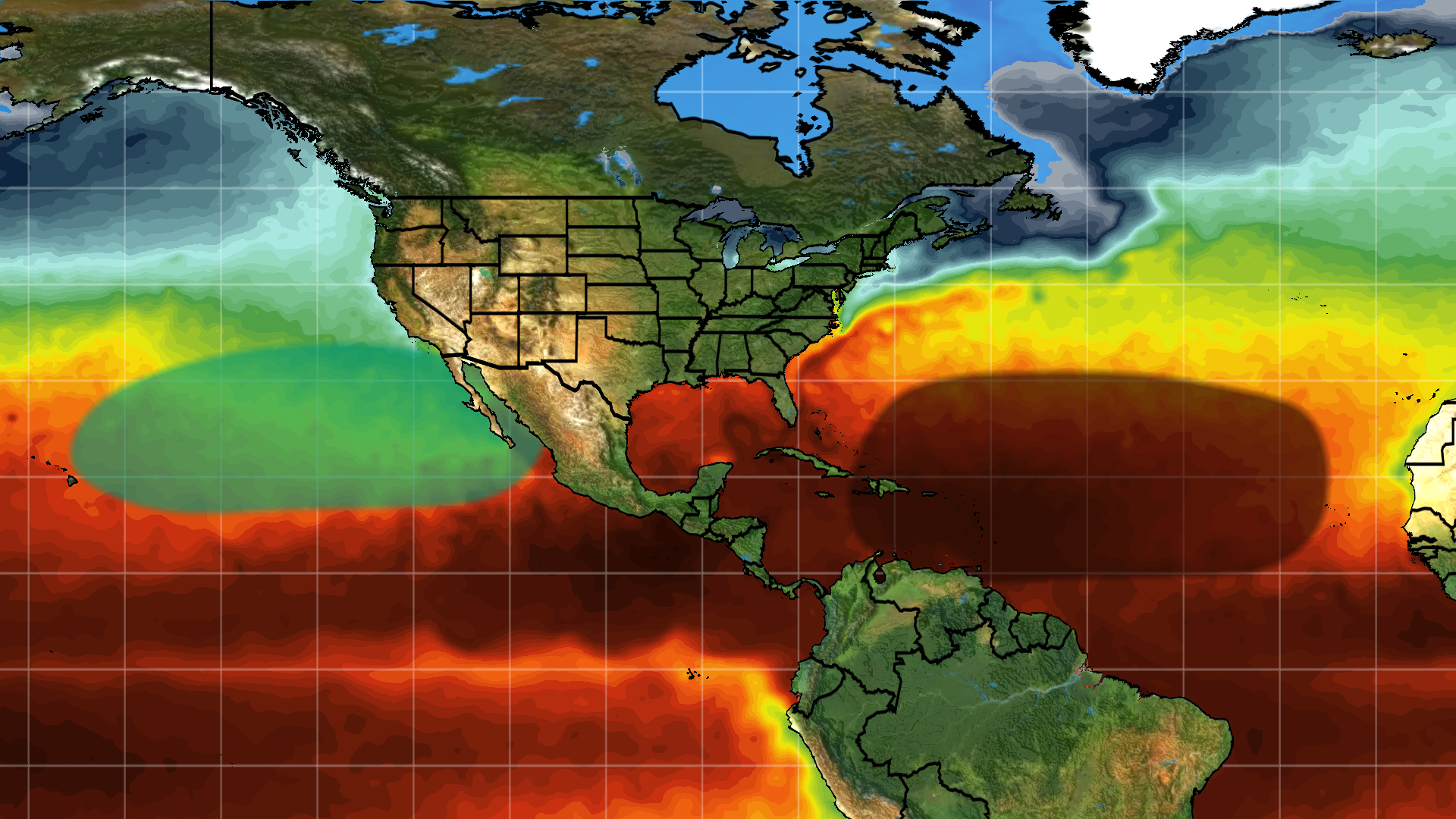
We’re now less than two weeks before hurricane season officially kicks off and the number of hurricanes expected this year continues to increase. Here are our latest expectations.