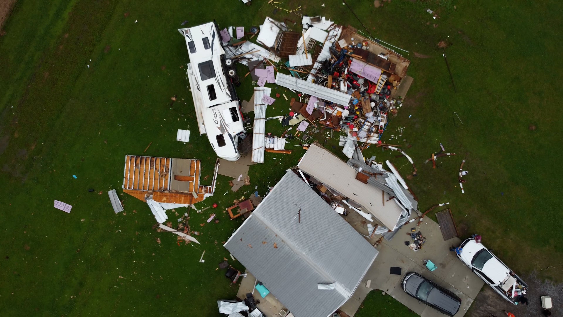
Forecast as of 3:03 PM CDT on July 5, 2009
Synopsis For The Middle Texas Coastal Waters
High pressure located across the central Gulf of Mexico and low pressure located across West Texas and Mexico will maintain a moderate to occasionally strong onshore flow today through Thursday. An inverted trough of low pressure will provide a chance for showers and thunderstorms Friday...as onshore flow weakens due to the formation of the surface low.
Forecast as of 2:50 PM CDT on July 5, 2009
Matagorda Bay-Galveston Bay-
Small craft should exercise caution through early evening
Tonight
South winds 15 to 20 knots...decreasing to 10 to 15 knots this evening. Bay waters choppy becoming slightly choppy.
Monday
Southwest winds 10 to 15 knots becoming south 5 to 10 knots in the afternoon. Bay waters slightly choppy decreasing to smooth in the afternoon. A chance of showers and thunderstorms.
Monday Night Through Tuesday Night
South winds 5 to 10 knots. Bay waters smooth. A chance of showers and thunderstorms.
Wednesday Through Thursday
South winds 10 to 15 knots. Bay waters slightly choppy. A slight chance of showers and thunderstorms.
Thursday Night Through Friday Night
South winds 5 to 10 knots. Bay waters smooth. A slight chance of showers and thunderstorms.
Date Time Tide Type Height
Freeport Harbor
2009-07-05 9:07 PM CDT Low Tide -0.78 feet
2009-07-06 6:00 AM CDT High Tide 1.57 feet
2009-07-06 9:42 PM CDT Low Tide -0.74 feet
Port Lavaca, Matagorda Bay
2009-07-06 2:37 AM CDT Low Tide -0.60 feet
2009-07-06 1:37 PM CDT High Tide 0.78 feet
2009-07-07 3:19 AM CDT Low Tide -0.59 feet
Port O'Connor, Matagorda Bay
2009-07-06 12:19 AM CDT Low Tide -0.63 feet
2009-07-06 11:40 AM CDT High Tide 0.62 feet
2009-07-07 1:01 AM CDT Low Tide -0.63 feet
Copyright © 2009 The Weather Underground, Inc.